Image Source: bobistraveling. Source License: CC BY 2.0. Adaptations: cropped.
Wetlands and undeveloped areas adjacent to streams (riparian buffers) serve as filtration mechanism to protect water resources from pollutants. Managing water resources is more than just conserving water. It includes protecting water bodies and riparian and wetland areas from development, and ensuring they are kept healthy, so that they can continue to perform this important water quality function.
Why is this important to your community?
Three major rivers, countless tributaries and numerous natural and man-made lakes and ponds serve the CONNECT Region. The three major rivers are the Catawba-Wateree River, the Broad River, and the Yadkin-Pee Dee River. To various degrees, all three are impacted by habitat degradation, shoreline development, water withdrawals, pollution, and sedimentation due to soil erosion from stormwater runoff.
Wetlands and riparian buffers around the rivers, streams, lakes and ponds provide natural stormwater filtration systems, cleaning stormwater runoff before it enters the water body. The vegetation within the buffer areas absorbs excess nutrients and sediment, controls erosion, moderates water temperature and provides habitat for wildlife. Buffers also provide flood control as they can naturally absorb fluctuations in water levels, protecting adjacent private property.
Despite these vast benefits, the protection of water and buffer resources has not been easy to achieve. Water bodies are natural draws for residents seeking recreation or hoping to live with a water view, and are also used to meet industrial, agricultural, and power generation needs. All these things put a strain on the water bodies and the buffers that protect them. As recently as 2013, the national organization American Rivers ranked the Catawba River as the 5th most endangered river in America. Storage ponds for coal ash, agricultural activity, hydroelectric power production, and past development were cited as straining natural hydraulic functioning and putting water quality in jeopardy.
Interventions are necessary to prevent further degradation our region’s water resources and to preserve them for the multitude of benefits they provide for economic development, meeting drinking water needs, human enjoyment and ecosystem functioning.
Skip directly to
How Does It Work?
Resources
Using the Tool
Partners
Where Has It Worked?
5
most endangered river in America - Catawba River
Where is it appropriate to use?
What priorities does it address?
What other tools are related?
How does it work?
Wetlands and riparian buffers are protected through purchases, easements, overlays, and through development regulations. Development regulations established by a municipality or county let developers and residents know how or where they can build. Typically wetlands and sensitive riparian areas (such as flood plains) are protected from development through overlays contained in the municipal development code. They may also be protected by outright purchase by the local government, or by a land trust for conservation; over ¾ of the shoreline of Mountain Island Lake has been either purchased or is held in trust to protect water quality for this primary drinking water source. In cases where the water resource has exceptional value to the state, a riparian buffer or wetland protection may be mandated at the state level.
Resources
- Center for Watershed Protection: Wetlands-At-Risk Protection Tool
- North Carolina Division of Water Resources
- American Rivers – Most Endangered Rivers for 2013
- South Carolina Department of Health and Environmental Control
- Federal Emergency Management Agency Flood Protection and Mapping Programs
- North Carolina Clean Water Management Trust Fund
Ready to get started?
Using the Tool
Watershed protection programs are established by either the state or by individual municipalities or counties. Model regulations are provided at the state level for the creation of local ordinances. Typically protection programs are instituted if a water body has come under scrutiny for poor water quality or is threatened by external stressors such as development or pollution. A program also may be considered to protect particular high-value water bodies such as those that supply drinking water. If no program exists at the state level the following steps may be taken to create such a program at the local level:- Research the rationale for creating a water resources protection program, including current threats to water body, evidence of poor water quality and degradation of aquatic habitat and ecosystem functioning, or critical community value for drinking water or recreational use (you can be proactive as well as reactive with this tool!).
- Work with local and regional environmental planners to discuss opportunities for creating a water resource protection program such as an overlay. Review the resources listed above for potential avenues that may make the most sense given the local need and situation.
- Petition the appropriate state department regarding interest of creating a water resources protection program either at the state or local level. Discuss the appropriate regulations and program management with the state department.
- Establish the buffer program at the state level that will be overseen through the appropriate state office, if it is determined to be in the best interests of the state and communities, and communicate with affected municipalities the implications for development and development review.
- If it is not possible or deemed not desirable to create a state buffer program, or if local leaders desire to create a stronger program than one offered by the state, create local protection as an article of the zoning code through the ordinance process.
- Once the appropriate tool(s) have been established at the state or local level, the development review process will ensure that the water resource is appropriately protected. This process involves map review and the preparation of development exhibits to illustrate best management practices (BMPs) for development in or near riparian areas, wetlands, or other sensitive water resources.
- Consider also working with Parks and Recreation departments to secure riparian buffers through purchase using bond funds or FEMA funds for passive recreation, trails, etc. These multi-use facilities serve the added purpose of educating the public about buffers and what is needed to protect water quality, and also can serve as wildlife corridors.
- It may be required to periodically monitor and report on the water quality of the subject water resource to illustrate that a discernible improvement has been made to the resource as a result of the protection program.
Partners
- Advocacy Groups
- Businesses / Business Associations
- Elected Officials
- Farmers / Agricultural Extension Office
- Landscape Architects, Planners, and Urban Designers
- Land Trust
Where has it worked?
Neuse & Tar-Pamlico Rivers Riparian Buffer - Raleigh, NC
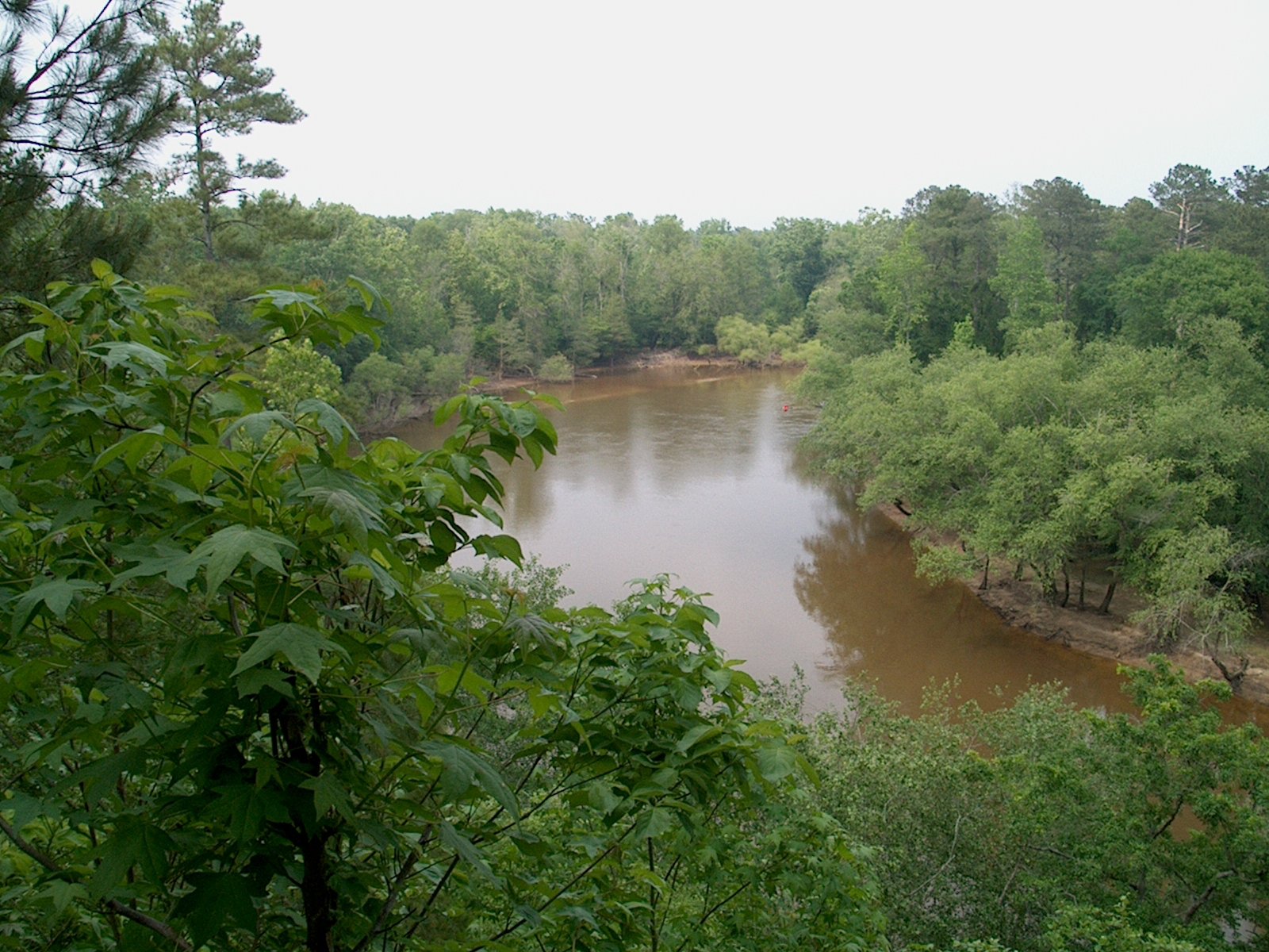 Image Source: Wyatt Greene. Source License: CC BY-SA 3.0.
Contact
Department of Environment and Natural Resources – Raleigh Regional Office
Office of Land and Water Stewardship
919-707-9123
Bryan.Gossett@ncdenr.govAbout the Program
In 1999, the North Carolina Environmental Management Commission (part of the Department of Natural Resources) adopted rules to protect a 50 foot buffer along waterways in the Neuse and Tar-Pamlico River Basins, located in Eastern North Carolina. The buffers were deemed valuable for their value in removing nitrogen, phosphorus, and other pollutants from rainwater that flows into the basins’ waterways, protecting waterways from their surrounding land uses. As a result, development is limited in designated water bodies associated with the river basins, thus protecting them for the long term and allowing them to fulfill their natural functioning.
Why it works
Riparian buffer rules apply to water bodies as defined by soil survey maps created by the Natural Resources Conservation Service (NRCS). These bodies include: perennial streams, intermittent streams, modified natural streams, lakes and reservoirs, ponds, estuaries and rivers. The riparian buffer must remain undisturbed, meaning no development is allowed therein, unless the use is listed as exempt, potentially allowable, or potentially allowable without mitigation. Allowable or potentially allowable uses may only be allowed with written authorization from the N.C. Division of Water Quality (DWQ). This tool for the protection of water resources is successful because it provides a state protection , rather than just local. The state protection supersedes local land use and zoning procedures, thus protecting a resource of regional benefit.
Watershed Overlay Districts - Mebane, NC
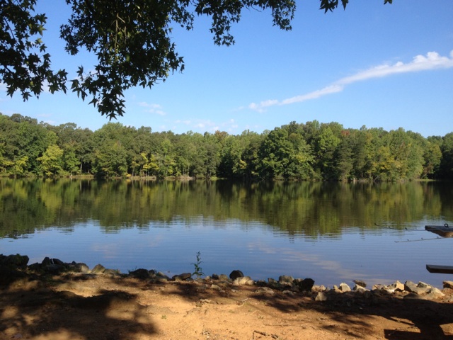 Image Source: bigstump21.
Contact
Montrena Wilson Hadley, Planning Director
mhadley@cityofmebane.comAbout the Program
The City of Mebane established watershed protection overlay districts to protect its public water supply watershed from activities which could degrade water quality. The city has two overlays which protect the Graham-Mebane Lake Public Water Supply Watershed. The overlays require the City of Mebane to adopt minimum land use regulations consistent with North Carolina Environmental Management Commission’s regulations for WS-II Critical Area and Balance of Watershed rules for development activity within city limits.
Why it works
The overlay primarily prevents the construction of new roads and bridges and non-residential development within critical areas, and encourages best management practices (BMPs) to minimize water quality impacts. A minimum 30-foot vegetative buffer for development activities is required along all perennial waters, including streams, rivers and impoundments, per the United States Geodetic Survey (USGS) maps, and a 100-foot buffer shall be required along Graham-Mebane Lake. Residential development within riparian areas is limited to one dwelling unit per acre of 12 percent built area. The overlay is overseen by the Zoning Administrator of the City of Mebane so is therefore part of the development review process for the city.
- Businesses / Business Associations